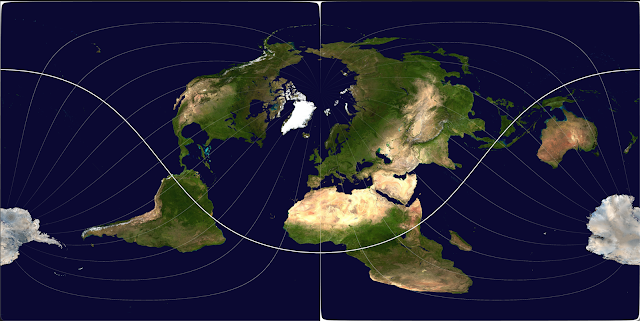
Londoncentric world map

Some people think that the world map centred on Greenwich is an unnecessary layover from the times of empire. Of Course, many countries issue maps with themselves more central. Living in London, with the nassim I have for home I felt that the longitude being centred in Greenwich wasn’t enough. I thought that the latitude should also be centred in Greenwich. The majority of world maps use what is called the Mercator projection. This is a projection based on putting the sphere of the world inside a cylinder. The position of a location on the globe projected onto this cylinder is then where it occurs on the map. This has the nuance of distorting the polls and making areas closer to the poles much larger than they actually are. There have been many attempts to change the projection using other techniques that push the distortions to different places. There are maps that attempt to keep the relative surface area of countries accurate to life. The nature of creating a flat representati...


